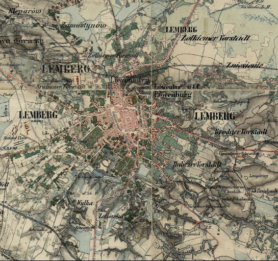
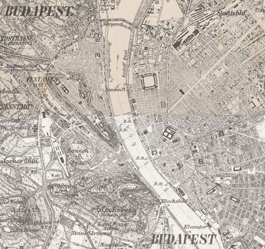
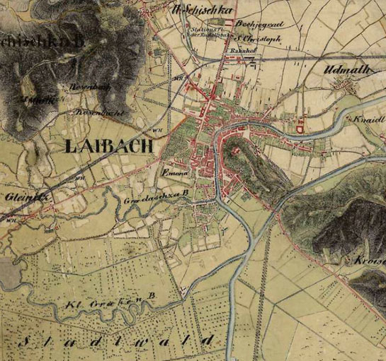
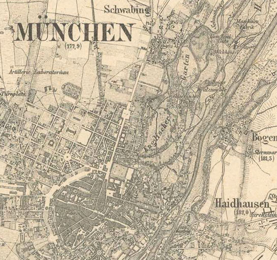
Europe in the XIX. century
Zakoupit segment
Stačí několik kliknutí a můžete si zakoupit a stáhnout naskenované obrázky v plném rozlišení.
Web Map Tile Service
Potřebujete georeferencovanou verzi? Díky naší službě WMTS můžete naše mapy nahrát na své vlastní webové stránky nebo do jakéhokoli geoinformačního softwaru.
Dostupný
Základní mapy
Historické mapy
Europe in the XIX. century
Související mapy

1:100,000 scale topographic map (Rektangelkart) of Kingdom of Norway

Bohemia (1842–1853) - Second military survey of the Habsburg Empire

Coastal Zone (1821–1824) - Second military survey of the Habsburg Empire

Croatia (1865–1869) - Second military survey of the Habsburg Empire

Dalmatia (1851–1854) - Second military survey of the Habsburg Empire

Ferrara
Galicia and Bucovina (1861–1864) - Second military survey of the Habsburg Empire

Grossherzogthum Baden (1838-1849)
Habsburg Empire (1869-1887) - Third Military Survey (1:25000)

Hungary (1819–1869) - Second military survey of the Habsburg Empire
Illyria (1829–1835) - Second military survey of the Habsburg Empire

Kingdom of Greece (1885)
Königreichs Bayern (1848)

Königreichs Sachsen (1821)

Königreichs Württemberg (1821-1851)

Lichtenstein (1816–1821) - Second military survey of the Habsburg Empire
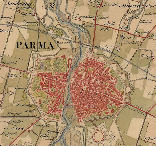
Lombardy, Venice, Parma, Modena (1818–1829) - Second military survey of the Habsburg Empire

Lower and Upper Austria (1819–1869) - Second military survey of the Habsburg Empire

Map of the southern provinces of Italy (1862-1876)

Moldavia (1892-1898)

Moravia (1836–1842) - Second military survey of the Habsburg Empire

Ordnance Map of England and Wales (ca. 1890)

Ordnance Survey of Scotland, ca. 1890 [B VI a 32]

Papal States and Tuscany (1841-1843)

Prussia (1877)

Russia (1872)

Salzburg (1807–1808) - Second military survey of the Habsburg Empire

Senate Atlas at the National Archives of Finland (1870-1907)

Styria (1821–1836) - Second military survey of the Habsburg Empire

Topographic and military map of the Kingdom of the Netherlands (1861)

Topographic map of Belgium (1846-1854)

Topographic map of France (1836)

Topographic map of Switzerland (1855)

Topographic map of the States on the mainland of S.M. the King of Sardinia (1852-1867)

Transylvania (1853–1858; 1869–1870) - Second military survey of the Habsburg Empire
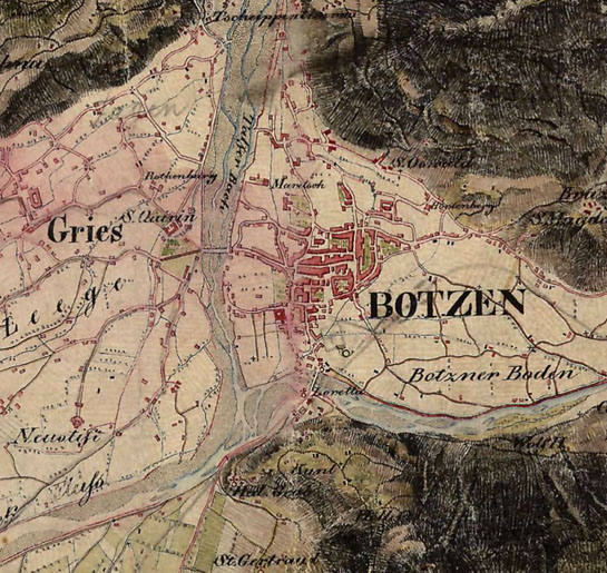
Tyrol (1816–1821) - Second military survey of the Habsburg Empire

Vorarlberg (1816–1821) - Second military survey of the Habsburg Empire
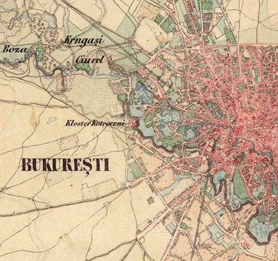
Wallachia - Second military survey of the Habsburg Empire


